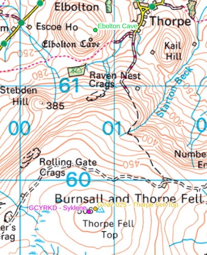
Finding interesting places to go with qgis
1) Get the list of places from megalithic.co.uk - fiddle with the web inspector
2) Get all the uk geocaches - browse to geocaching.com, fiddle the map to get the view you want and look for promising url in the inspector.
3) Copy that as a curl command to get the session and paste it into download_ny_dales_geocaches.sh
4) Get the list of sota summits from: https://www.sotadata.org.uk/summitslist.csv
5) Get the set of pota parks: run download_uk_pota.sh
6) Get the list of trig points from https://www.ordnancesurvey.co.uk/gps/legacy-control-information/triangulation-stations, https://www.ordnancesurvey.co.uk/documents/gps/CompleteTrigArchive.zip
7) Fire up the qqis project
duckdb is great for this sort of thing too. Wonder of we can capture this output in qgis?
$ duckdb
v1.1.3 19864453f7
Enter ".help" for usage hints.
Connected to a transient in-memory database.
Use ".open FILENAME" to reopen on a persistent database.
D INSTALL spatial;
D LOAD spatial;
D D SELECT
    reference,
    LEFT(name, 25) as name,
    qsos,
    ROUND(ST_Distance_Sphere(geom, ST_Point(0.1, 52))/1000, 1) as distance
  FROM
     ST_Read('pota_uk.geojson')
  ORDER BY distance ASC
  LIMIT 10;
| reference | name | qsos | distance |
|---|---|---|---|
| GB-0045 | Fowlmere RSPB Reserve | 177 | 11.3 |
| GB-3256 | Grange Paddocks Park | 0 | 15.5 |
| GB-2324 | Wandlebury Country Park | 14 | 20.0 |
| GB-0305 | Hatfield Forest National | 358 | 21.2 |
| GB-1656 | Coton Country Reserve | 23 | 22.6 |
| GB-0296 | Lee Valley SPA (including | 212 | 27.1 |
| GB-2326 | Milton Country Park | 44 | 27.2 |
| GB-0388 | Fairlands Valley Park Cou | 88 | 32.9 |
| GB-2325 | Devil's Dyke Site of Sign | 21 | 37.2 |
| GB-0336 | Fen Drayton Lakes RSPB Re | 584 | 37.3 |
